Geology
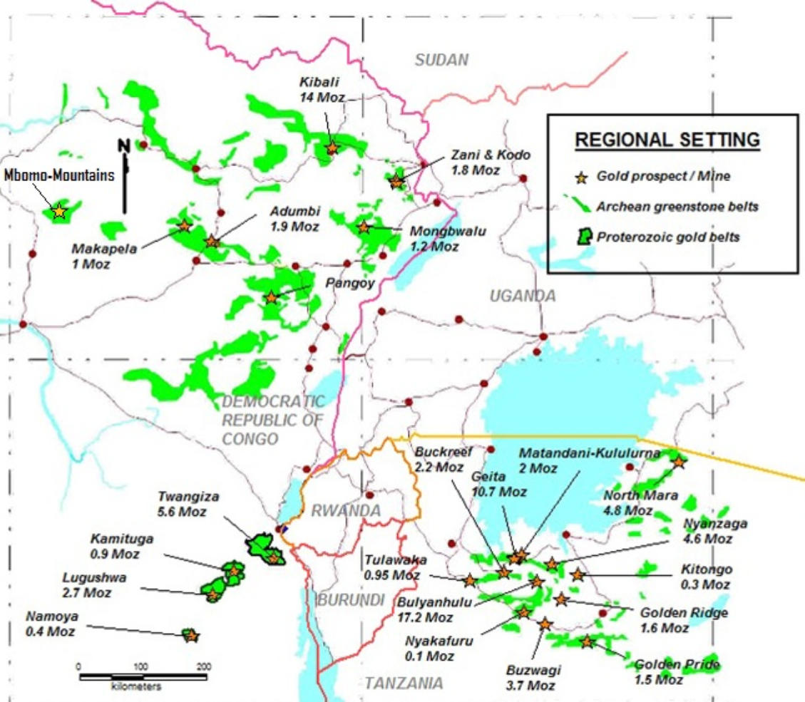
Mbomo area belongs to the « Massif granitoïde du Haut-Zaïre », which is composed of high grade
migmatitic series, typical amoeboïdal granite patches and epimetamorphic greenstone belts
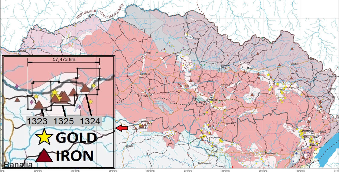
The “Tele Belt”, covered by the M'Bomo permits, belongs to a NNW rosary of similar “greenstone”
terranes running from Tanzania to Central Africa Republic .
The epimetamorphic greenstones extend over several cycles, some older than 2.9 b.y. And some as
late as Lindian sediments rest on the north and south flanks of the « Massif ». Southwards the
sediments dip into the large Congo Basin.2.0 b.y.
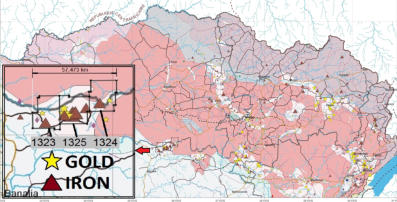
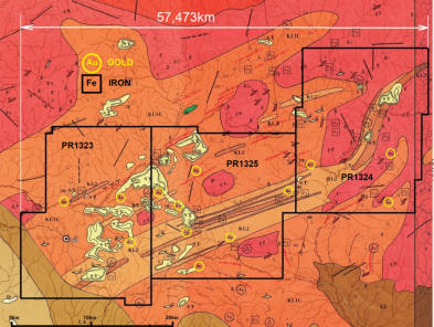
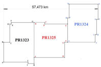
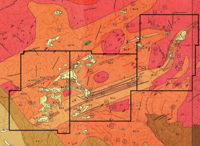
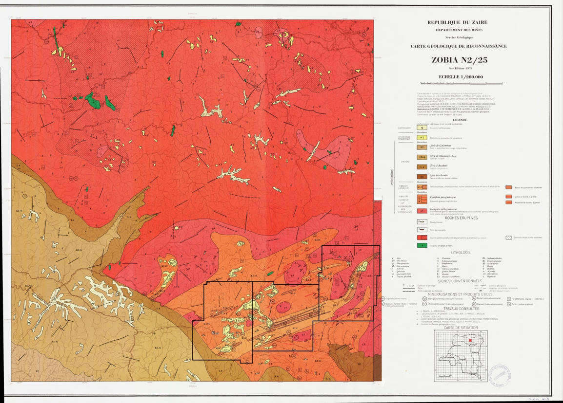
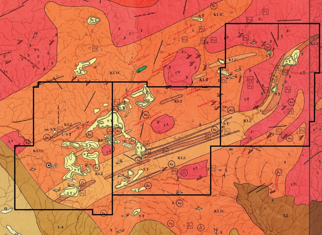
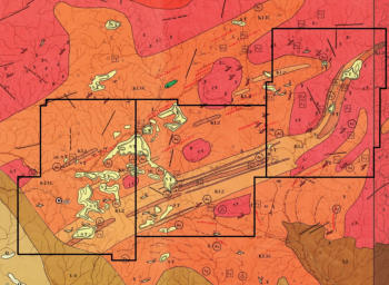
Formations outcropping in the permit are shown in the picture extracted from the Zobia 2/25
reconnaissance map at scale 1/200,000 (BRGM 1975).
Two brown lithologies, in the SW and SE corners of the leases, belong to the Lindian cover
formations, dating from Upper Precambrian and made of arkoses, sandstones and claystones
becoming carbonaceous at the bottom of the sequence (L2, L4 and L5).
The Lindian cover rests over the granite/greenstone complex (massif) . The red and purple
features granite (G) and gneisses( ɣ ) ; the contorted orange features the lower Kibalian (KI1) and
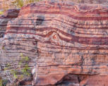
the two brown tints the upper Kibalian( KI2), darker brown features the banded ironstones (BIF).
The typical circumscribed granites crop out inside the belt, these late, tarditectonic, granites with
two micas , are shown in red.
Recent residual sandy formations rest on lower grounds (ST).
Not drawn on this map is a ENE shear zone following the
southern edge of the BIF
click to enlarge


Mbomo area belongs to the « Massif granitoïde du Haut-Zaïre
», which is composed of high grade migmatitic series, typical
amoeboïdal granite patches and epimetamorphic greenstone
belts
The “Tele Belt”, covered by the M'Bomo permits, belongs to
a NNW rosary of similar “greenstone” terranes running from
Tanzania to Central Africa Republic .
The epimetamorphic greenstones extend over several cycles,
some older than 2.9 b.y. And some as late as Lindian
sediments rest on the north and south flanks of the « Massif ».
Southwards the sediments dip into the large Congo Basin.2.0
b.y.
Formations outcropping in the permit are shown in the picture
extracted from the Zobia 2/25 reconnaissance map at scale
1/200,000 (BRGM 1975).
Two brown lithologies, in the SW and SE corners of the
leases, belong to the Lindian cover formations, dating from
Upper Precambrian and made of arkoses, sandstones and
claystones becoming carbonaceous at the bottom of the
sequence (L2, L4 and L5).
The Lindian cover rests over the granite/greenstone complex
(massif) . The red and purple features granite (G) and
gneisses( ɣ ) ; the contorted orange features the lower
Kibalian (KI1) and the two brown tints the upper Kibalian(
KI2), darker brown features the banded ironstones (BIF). The
typical circumscribed granites crop out inside the belt, these
late, tarditectonic, granites with two micas , are shown in red.
Recent residual sandy formations rest on lower grounds (ST).
Not drawn on this map is a ENE shear zone following the
southern edge of the BIF

Geology